Raytown Rd, Kansas City, MO 64149
Eighty acres bordered on the west by federal Longview Lake land, with over four thousand feet of road frontage and the Kansas City skyline rising on the northern horizon. Tillable, timbered, watered, and quiet.
“Gently rolling topography slopes from north to south toward a small creek, creating subtle elevation changes while remaining largely level and easy to navigate.”
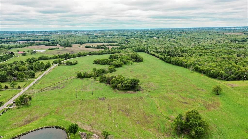
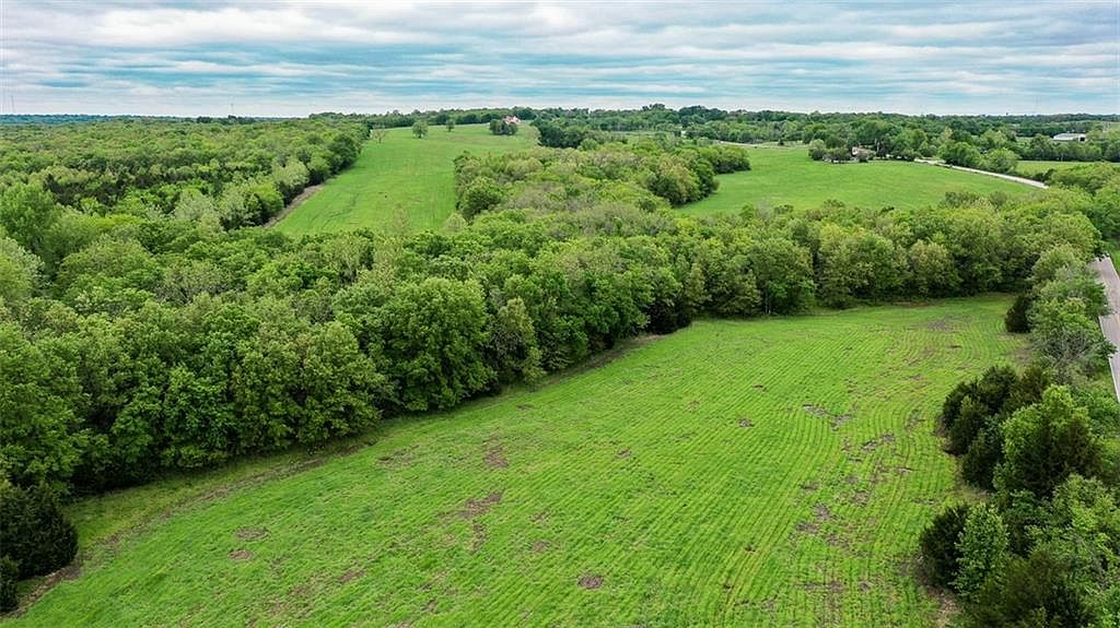
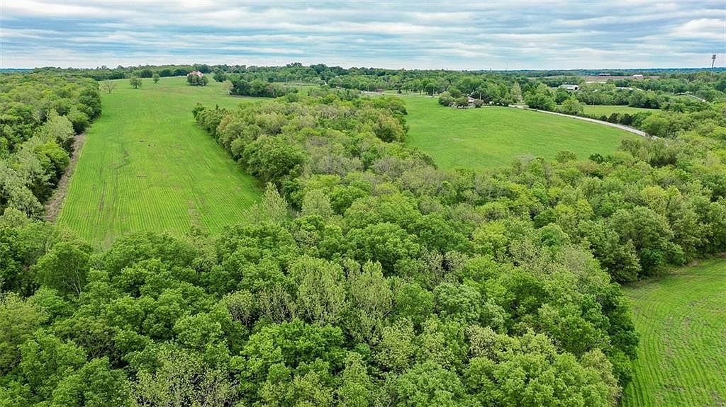
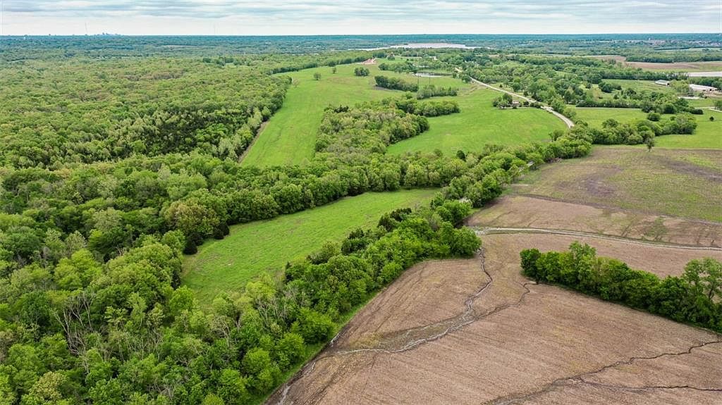
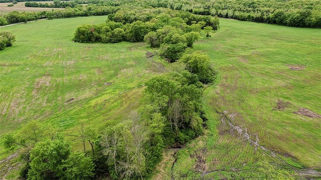
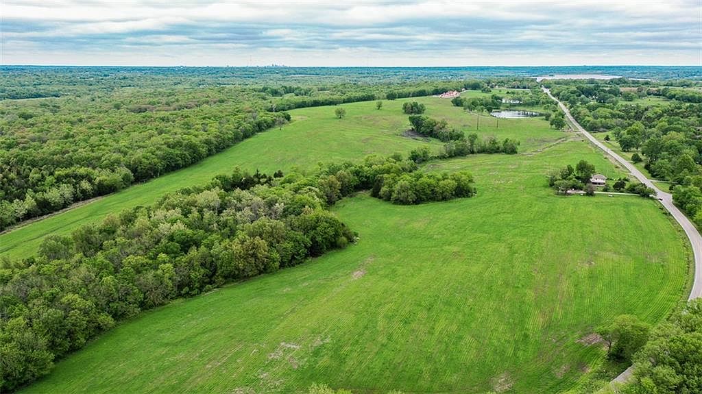
An eighty acre tract just south of Longview Lake. Approximately fifty five acres of tillable ground sit between expansive open fields and pockets of mature timber, the layout itself reading like it was drawn to be used. Gently rolling topography slopes from north to south toward a small creek, creating elevation changes that feel subtle on foot and dramatic from the air.
The western edge borders well managed federal land associated with Longview Lake, providing a scenic backdrop and excellent wildlife habitat. Deer and turkey are seen daily. Traces of historic Old Raytown Road can still be found along the western property line, adding a quiet sense of continuity with the land's earlier life.
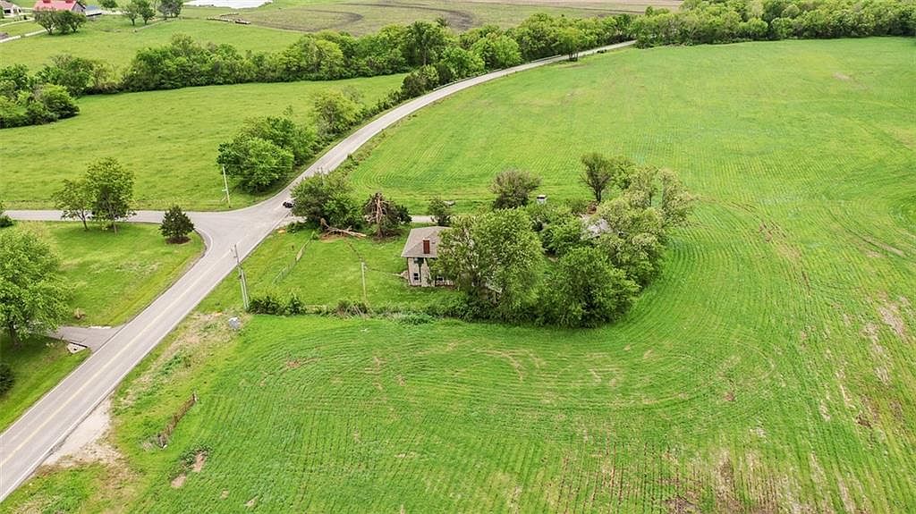
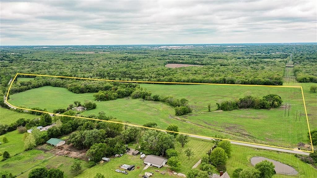
A century old home sits in relatively good condition near the eastern frontage. An existing water main runs along Raytown Road on the eastern edge, with public sewer access located just to the south. Over four thousand feet of road frontage offers exceptional access.
A private estate, a recreational retreat, or a future development hold. Between two lakes, on the southern shoulder of one of the most rapidly absorbing corridors in greater Kansas City, with the city's skyline holding the horizon line.
Federal frontage. A boundary that cannot be subdivided.
A single contiguous tract of this scale, this close to the Kansas City metro, simply does not come to market often. Roughly fifty five acres of that are tillable, supporting both income and use flexibility.
The western property line borders federal land tied to Longview Lake. That edge will never be developed. The lake's wildlife corridor walks straight through this parcel.
Raytown Road runs the entire eastern boundary. Access is everywhere. Subdivision potential is everywhere. So is the easy private drive option.
An existing water main runs along the eastern property line. Public sewer is available immediately to the south. The infrastructure work that gates most rural development is already done.
The topography slopes north to south, draining gently toward a small creek. A pond rounds out the southern shoulder. Water, sound, wildlife habitat, and a natural building site, all here.
A hundred year old farmhouse sits near the eastern frontage in relatively good condition. Continue the structure, restore it, or use it as the staging point for what you build next.
Adjust the inputs below to see your estimated monthly payment. The number updates in place.
Principal and interest only. Taxes, insurance, and any agricultural or homestead exemptions not included.
The parcel sits in the corridor between Grandview and Lee's Summit, with Longview Lake just to the north and Smith's Fork to the southeast. Downtown Kansas City reads on the horizon to the north at about a twenty minute drive.
The Longview Lake park system, federal land managed by the US Army Corps of Engineers, includes nine miles of paved trail, a beach, two marinas, and one of the largest off-leash dog parks in the metro. The parcel's western boundary touches this network directly.
Lee's Summit is fifteen minutes east. Grandview is ten minutes west. Both put schools, grocery, dining, and the highway at hand without putting them on the parcel itself.
Tours are by appointment. Schedule a private walk of the parcel, the home, and the western timber line. We will be in touch within one business day.